Emlid
Reach RX 2
GNSS reciever
For scanning and documentation of underground utilities, construction sites, as-builts, and forensics.
- Plug and play solution
- Integrated with Vaira
- 1.999 excl. VAT
Powerful out of the box
No training is required
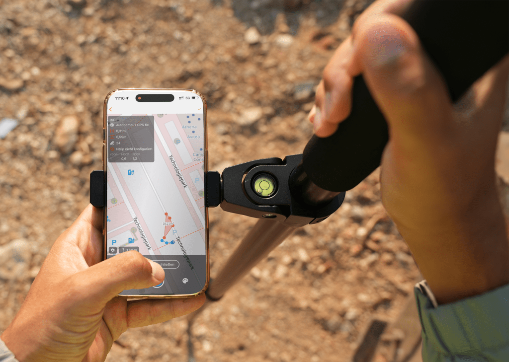
Reach RX2 is preconfigured with no settings to get wrong. Anyone in the team can use it to collect accurate data.
Works with any CORS
Gets RTK corrections from any CORS or NTRIP service in RTCM3.
High-accuracy, even under canopy
Reach RX2 tracks all bands of GPS, GLONASS, Galileo, Beidou, QZSS and NavIC. This ensures fast fix and stable performance even in challenging conditions.
High-accuracy, even under canopy
The RX2 maintains centimeter accuracy even at high tilt angles.

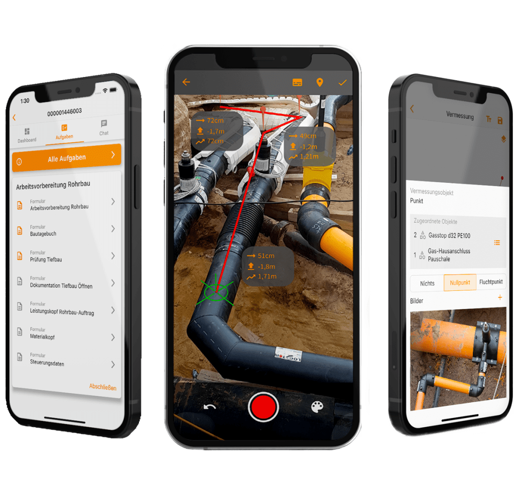
Digital construction files and 3D models
Unlock your full potential with Vaira
Reach RX2 is fully integrated into Vaira. Your digital processes are directly enriched with all survey data. This allows other parties involved on construction sites and in offices to continue working immediately. At the same time, Vaira can also create a 3D model of the project on request. This allows you to optimize your construction documentation and make your services more transparent than ever before. Your documentation will also be future-proof for BIM and CIM.
- Perfect for performance verification in construction projects
- No setup required
- Absolute positioning of 3D models
- Automatic creation with every survey
- Optimal solution for FTTx expansion
Compact and rugged
Ultra-lightweight and pocket-sized
Weighs only 280 g and fits in a pocket. Take Reach RX2 with you wherever you go.
16 hours on one charge
2 days of work on 1 charge. Charge Reach RX2 from any USB port or power bank.
Withstands -20 to +65ºC
Reach RX2 works in the coldest winters and hottest summers.
Fully compatible with Vaira
Reach RX2 integrates with Vaira for seamless data flow between the field and the office.
With Vaira, the survey data is instantly accessible to all stakeholders for continued work. At the same time, Vaira automatically generates a 3D model of the construction site from the field data.
The integrated process ensures your data is compatible and compliant with BIM and CAD projects.
Technical specifications
Mechanical
Dimensions
172 x 51 x 51 mm
(6,77 x 2,00 x 2,00 pol)
Mount
5/8”-11 UNC
Weight
280 g (0.62 lb)
Operating t°
-20 to +65 ºC (-4 a 149 °F)
Ingress protection
IP68 (maximum depth of 1.5 meters
up to 30 minutes)
Electrical
Autonomy
Battery
Li-Ion 7000 mAh,
3.6V, 25.2 Wh
Charging
USB Type-C, 5V 2A
Certification
FCC, CE, IC, MFi
Positioning
RTK
H: 7 mm + 1 ppm
V: 14 mm + 1 ppm
Tilt
RTK + 2 mm + 0.3 mm/°
Convergence time
~5 s typically
GNSS
Signal tracked
GPS: L1C/A, L2C, L5
GLONASS: L1OF, L2OF
Galileo: E1-B/C, E5a, E6
BeiDou: B1I, B1C, B2a, B3I
QZSS: L1C/A, L1C/B11, L2C, L5
NavIC: L1-SPS Data, L5-SPS
Number of channels
672
Update rate
5 Hz
Connectivity
Communication interface
Bluetooth 4.2
(BR/EDR + LE)
Ports
USB Type-C
Data
Input data format
RTCM3
Input data protocol
NTRIP
Position data format
NMEA