Flat rate that pays off immediately

Increase your productivity

Utilities, construction companies, and craftsmen of all sizes use Vaira to digitize their work. With Vaira, you get a secure, flexible, and predictable tool to efficiently complete all tasks.

14 days trial

No costs, no obligations—your trial period ends automatically. Test with as many users as you like.

free

All Advanced features

Essential

Get started with digital processes using augmented reality, digital sketches, and georeferenced photos

from

€ 33,04

monthly per user

Highlights

RECOMMENDED

Standard

High-quality GNSS surveying and staking out using a smartphone, custom export designs, and API access

from

€ 81,20

monthly per user

Highlights

Advanced

Future-proof documentation through 3D scans, 3D model surveying, and comprehensive business management

from

€ 155,80

monthly per user

Highlights

14 days trial

No costs, no obligations—your trial period ends automatically. Test with as many users as you like.

free

All Advanced features

Essential

Get started with digital processes using augmented reality, digital sketches, and georeferenced photos

€ 55,13

monthly per user

Highlights

RECOMMENDED

Standard

High-quality GNSS surveying and staking out using a smartphone, custom export designs, and API access

€ 135,68

monthly per user

Highlights

Advanced

Future-proof documentation through 3D scans, 3D model surveying, and comprehensive business management

€ 259,67

monthly per user

Highlights

Vaira App auf einem Smartphone, gehalten von einer Hand über einem Baugraben.

Vaira Essential

Getting started with simple surveying, georeferenced photos, and your own processes

You’re just getting started with digitalization. You mostly work on small construction sites, documenting simple utility connections, and your workflows are fairly straightforward, involving few people and no external companies.

All you need is to fill out forms on your smartphone and measure with augmented reality to within 10 cm of accuracy, so you can print out a PDF sketch of your measurements and send it to your client. You still want to be able to take advantage of the digital sketch in the office. That’s why you’re looking for software that makes work on the construction site more efficient and transfers the data directly to your office.

Plus, you don’t want to have to worry about data storage, software updates, or the future viability of your software. Just click and get started—no major projects or endless training required.

Foto aus der Luft von einem Monteur in orange-farbener Baustellenkleidung mit weißem Schutzhelm. Er hat ein Smartphone in der Hand und dokumentiert gerade in der Vaira App. Links ragt außerdem ein gelber Baggerarm ins Bild.

Vaira Standard

High-quality measurement results through GNSS surveying with correction services, custom export formats, and API access

You’re ready to take your workflows to the next digital level. You survey not only small construction sites but also larger projects—and therefore need solutions that achieve centimeter-level accuracy even over distances of several kilometers.

That’s why you rely on centimeter-accurate GNSS smartphone surveying with external RTK receivers from providers like Trimble, Leica, Emlid, PPM, Stonex, or vigram—complete with NTRIP correction services, of course. Together with Vaira, you want to turn each of your field technicians into a surveyor without extensive training.

You want your measurements via augmented reality or GNSS to be expandable to include georeferenced objects such as building components or work items. Time tracking should also be part of your digital solution.

You also recognize the potential of automated processes and want to coordinate multiple stakeholders in the process fully automatically. You no longer want to print out your results, but rather continue working with them in a meaningful way using digital data—whether in common raw data formats or directly via an interface into your systems.

To coordinate your specialists, you want a freely configurable user and role management system that defines read, write, and delete permissions down to the smallest detail.

Ein freigestellter Arm mit einer Trimble DA2 Antenne in der Hand und einem Smartphone, auf dem die GNSS-Vermessung mit der Vaira App läuft.

Vaira Advanced

Future-proof documentation through 3D scans, 3D model surveying, and comprehensive business management

You’re ready to embrace the latest technologies in digital construction documentation and want to get the most out of Vaira.

You want to create georeferenced 3D models simply by walking through the construction site and have the ability to measure them later in the office. You also value having access to the raw point clouds so you can continue working with them in your own systems.

You want to be able to edit your digital sketches later—using custom sketch backgrounds such as map data, freely positionable additional text, and specific component symbols instead of simple points.

You also want to allow external companies to work with your data according to your own rules. For optimal data security, you rely on traceable audit logs and want to use single sign-on methods for your users.

Your Vaira licences

Our carefully curated packages include exactly the features you need for your daily digital work at a convenient flat rate. Simply compare which package best suits your team’s needs.

Essential

Standard

Advanced

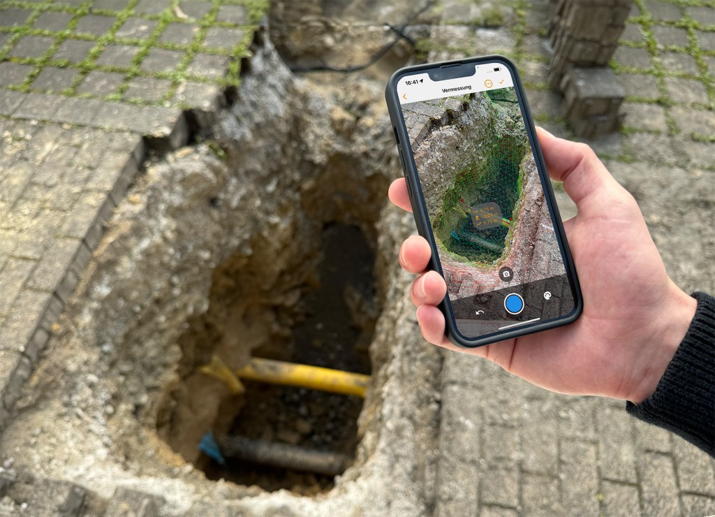
Surveying and documentation

Record on site – continue working in the office

AR surveying

Multi-division surveying

Automatic photo evidence

Offline functionality for uninterrupted work on construction sites

Exports (PDF in DIN A4 to A0 formats)

Show/hide and move ordinates and abscissas

QR and barcode scanner and text recognition for fast data capture

AR quick measurement for individual distances, areas, and volumes for direct field values

Automatic metadata capture (mobile phone model, time stamp, software version, etc.)

Preliminary surveys for planning based on existing PDF site plans

Free texts and symbols in sketches

User defined repositioning of measure values within the digital sketch

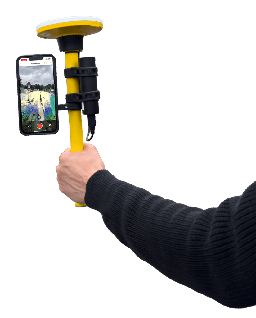
GNSS surveys with your smartphone

Connection of external GNSS receivers (Trimble DA2, Emlid Reach RX and RX2, viDoc®, viDoc® light, ppm 10xx, STONEX GNSS S599, and others)

Integration of RTK into GNSS surveying

Free choice of NTRIP service (e.g., SAPOS)

Enabling a georeferenced OSM map background for planning and follow-up checks in the office

Creating georeferenced plans and cost estimates using map data

Creating latitude/longitude waypoints, lines, and polygons on plans and OSM base maps

Export of all measurement data to all common geographic formats

Duplicating measurements

Assignment of directory objects (materials, machinery, services, topography, etc.)

QR and barcode scanners linked to internal databases (inventory tracking, ID numbers, etc.)

File exports (DXF, Shapefiles including database files, CSV, GeoJSON, photos, etc.)

Conversion of survey data exports into any coordinate and elevation reference systems (e.g., UTM and DHHN2016, etc.)

3D scans of construction sites with a smartphone

Create and export point clouds

Create and export 3D models

Generating georeferenced X/Y/Z points, lines, surfaces, and volumes in 3D models

Export of all measurement data from 3D models to all common geodetic formats

Unlimited creation and reconstruction of 3D scans – flat rate for your models

Workflows

Automate workflows smartly

Custom processes in the workflow builder

Workflow authorization control

In-app and email notifications

Custom task dashboards (widgets, cards, authorization control)

Process views (columns, filters, permissions, categories)

Custom lists & directories (material masters, specifications, specialist modules, time recording, machines, devices, etc.)

Automation (calculations, condition-dependent workflow branches, plausibility checks, order synchronization)

PDF exports in your own design (measurement sketches, measurements, welding reports, etc.)

Custom process reports with real-time status (also as CSV export)

Creation and management of symbol directories

Branched list objects (multi-day reports, pipe branches in pipe sequence lists, construction phases, billing classes)

Organization, users, and permissions

Control and data security in your hands

Your own Vaira organization

User and group management

Permission control within groups

Role-based permissions

Customizable role concept

Subcontractor control (management of organizational units)

Audit logs and protocols of all data changes

Single sign-on (Apple, Google, Microsoft)

Interface

Connect Vaira to your other systems such as ERP and GIS

Open RESTful API for your system connection

Own management and authorization of authentication tokens

Custom process and field annotations for communication via API

Operation and maintenance

All services included in a flat rate with one license package

Provision of apps in the App Store and Play Store

Includes operation and maintenance of the iOS, Android, and web apps, including backend

Free continuous updates and activation of new features in accordance with the license

Comprehensive knowledge base with step-by-step instructions and training videos

Data processing, data backup, and hosting in compliance with GDPR in Germany and the EU

Support via ticket system

Support via telephone

Companies trust Vaira

Hike on established trails – or discover entirely new ones

Many companies have already paved the way. Our team has the expertise to digitize construction companies, utilities, and skilled trades. Whether you want to go it alone or need help with digitization, the Vaira team is happy to assist you.

» Plan a call via the calendar