




































mehr erfahren
Vaira is built and optimised for every utility – fibre included. With Vaira’s Digital Construction Support you document both the entire route and every service connection directly, digitally and ready to submit.
Automatically generated 3D model
Planning for your own and external crews
For network level 3 (NE3) and network level 4 (NE4)
Automatic mark-up onto plans
Conventional civil engineering & trenchless construction
Fibre, coaxial & copper cables
Photo documentation, freely and automatically
Whether it’s a line, a trench or a road – fibre, water, electricity, gas, district heating or wastewater: conventional civil engineering or trenchless, with Vaira you work paperless, digital and in real time right on the construction site.
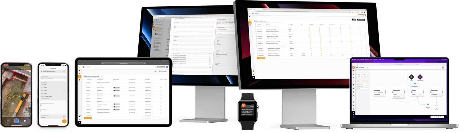
From planning through execution to ongoing maintenance – whether it’s your own crew or a service provider: with Vaira all data is captured digitally, bundled centrally and handed straight over to asset management, GIS and billing.
learn more
Whether you collect the data yourself or receive it from the site: with Vaira you keep all information digital, central and structured – from planning to handover, transferable seamlessly into CAD, BIM or documentation.
learn more
Whether it’s your own job or one as a subcontractor – with Vaira you have all your information digitally in one place. From quantity take-off to acceptance: all data comes together centrally and is instantly ready for planning, documentation and billing.
learn more
With the Vaira app you can do everything on site. Within seconds you've effectively finished the whole thing. What's changed with documentation through Vaira: everything is faster and more consistent.
It really doesn't get any better.
Translated from original german interview.
Torsten Köppert
Civil engineering specialist
Hermann Tönjes GmbH
Many companies have already paved the way. Our team brings the expertise to digitalise construction firms, utilities and skilled trades. Whether you want to get going on your own or need a hand with digitalisation – the Vaira team is happy to help.
Uwe Kopplin
IT Process Manager
EWE Netz GmbH
all testimonials
With Vaira you scan EAN and traceability codes to capture your lists. Say goodbye to slow, error-prone copying by hand!
browse examples
Capture points, lines, areas, volumes, photos and local & absolute 3D UTM coordinates with ease.
A dynamic pipe log from planning to completion. All values calculate themselves automatically.
Process and share data straight from the machine. The log writes itself.
Work recording, volumes, quantity calculation. Everything is captured billing-ready right on the site.
Scan the meter reading and serial number. Tariff changes and customer data updated instantly.
Scan material via QR/barcode. Traceability, batches, quantities and inventory stay in sync.
Assignments, notifications and organisational units. Everyone always has the data they need.
Billing can start while the crew is still packing up on site. All data always at hand.
Record labour and machine hours during the works. Invoices are available at any time.
Transfer inspection data from the machine and the report for your client writes itself.
With its Software-as-a-Service approach, Vaira enables real-time data exchange and smooth communication. This is made possible by state-of-the-art cloud technology that handles even compute-intensive tasks anywhere and in seconds – at a fraction of the cost of running a maintenance-heavy on-premise solution on your own servers.
All data is mirrored multiple times and every communication is stored encrypted in the data centres. That way your data stays safe and accessible even if individual servers fail.
Our infrastructure is operated in Germany and meets all GDPR requirements. We protect your data against targeted attacks with extensive security measures.
Vaira develops its software entirely in-house in Germany. That keeps the distance between the trench and software development as short as possible. The highest quality and security are guaranteed.
All the tools, one platform: with competent and reliable partners, Vaira brings together everything from hardware to software to services for the complete construction-site solution.
discover all partners
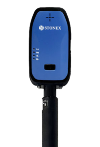
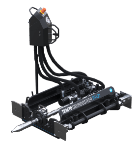
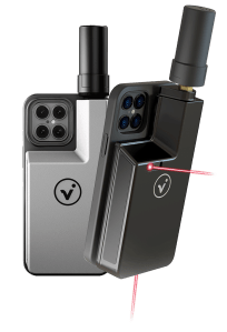
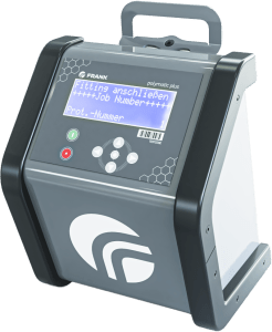
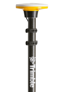
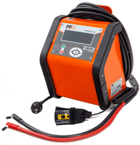
Great software only shows its strength with reliable hardware. That's why we rely on close partnerships with leading manufacturers – making sure Vaira runs stably, quickly and precisely everywhere.


Vaira offers extensive interfaces that connect all relevant systems and processes seamlessly. Together with our software partners we build a stable foundation for smooth operations, efficient collaboration and future-proof integrations.
Come rain or shine, only one thing counts in the utility trench: it has to work! Field technicians – the unsung heroes of everyday life who keep our homes warm and bright, the water running and the internet stable – deserve the best software.
In 2016, Max Erdmann had the idea for the first digital surveying app for utilities and the construction industry. As early as 2017 his concept won the OWL Innovation Award, and in 2018 came the quality label from the University of Paderborn for the first surveying app – one that set new digital standards in the industry at the time.
But surveying alone wasn’t thinking big enough.
So since 2019 he and his team have been building a comprehensive digital platform: from the original idea of a simple surveying app grew the idea of Vaira – a professional digital toolkit for mapping tasks and processes of all kinds, solving the daily challenges of the energy transition, fibre rollout and basic utility supply digitally. Among others, the German Federal Ministry for Economic Affairs and Transport lent its support.
With the Vaira flat rate you scan your construction sites as often as you need – with no per-unit costs or hidden fees. 3D models and point clouds are generated automatically and are ready straight away in the Vaira Office web app.
Thanks to AR feedback you can see instantly while scanning whether everything has been captured – no more going back twice.
All data can be exported to PDF, Shapefile, DXF or GeoJSON. You can also download the 3D model and point cloud directly, or pass them on to clients and partners automatically.
Flat rate for 3D scans
Effortless to use
Quality indicator while scanning
Capture materials & work items on the spot
With or without a LiDAR sensor
Interface to the client
Your data, your control
With every scan, Vaira automatically creates a complete, georeferenced photo documentation – with no extra effort. Every image is precisely located, time-stamped and saved straight into Vaira Office.
That gives you a precise, traceable record at any time – for acceptance, documentation or your client.
Vaira runs on all common smartphones and tablets – whether Android or iOS. You need no special hardware and can start right away, with the device you already use.
Not every use case needs maximum accuracy. With Vaira you create 3D scans cost-effectively – entirely without an RTK receiver and without major compromises on positional accuracy.
Whether entry-level device or high-end kit: every recommended device is field-proven and built for professional use. Our constantly updated portfolio gives you the right solution for every use case – reliable, robust and ready to go.
In the Vaira Office web app you edit your 3D scans right in the browser – with no additional software. Download the point cloud and 3D model instantly and be the first to have access to all the data.
A real highlight: the surveying happens comfortably from the office – from the scan you can generate all the results for your client directly. In just a few clicks you capture points, lines, areas and even volumes.
Assign materials and work items directly in the model, add symbols, text or backgrounds – and export everything billing-ready, just as colleagues, customers and partners need it.
Use Vaira independently of the individual client and flexibly across all sectors and trades.
Through the web app and the smartphone app you recreate your paper documentation using logics that make sense digitally – making future work enormously easier and faster.
Generate print-ready PDFs straight from Vaira in your usual style: complete with logos, the same text formatting and the clean digital drawings of your surveys. All in a single click.
Goodbye notebook – with Vaira all your jobs are always to hand, in your pocket or on your computer. Real-time syncing across every device keeps your data bang up to date, and digital search and filters keep it easy to survey.
Whether it’s work items, components or line items for site inspections – bring directories of any size together in Vaira in an audit-proof way, so you can easily reference them in your documentation and surveys.
Versioning makes sure your older records keep running smoothly, while new ones always draw on the latest version of the directory.
With the import function you can hand your existing directories over to Vaira in table form.
Intuitive component capture on site
Referenceable in surveys
Dynamically adjustable directories
Audit-proof and always up to date
Importable as a table
Easy to maintain and manage
Create directories for your building materials. You decide for yourself whether to work with large master directories or a separate directory per trade, for example.
Map your price catalogue in Vaira and link billing items directly to the work carried out. The clear documentation prevents queries and saves both construction firms and clients effort.
Records, for example for site inspections, can be time-consuming. With digital directories you can carry out these and other standardised checks far more efficiently.
Record your stock levels with up-to-date directories, ready to output straight away as a PDF in reports or available via an interface for other software.
These four examples can be extended however you like. There’s no limit to your creativity in building your own directories and discovering new use cases.
Away from paper means towards simpler workflows. Speed up the handover of documentation to a matter of seconds. Others involved can view the record directly and carry on working with it.
Link fields together logically to, for example, run calculations automatically while you document. Quantities of components, prices and work items can then be reconciled correctly right on the construction site.
Correct data in the correct places is the be-all and end-all of good documentation without queries. Unlike on paper, you can control digitally which entries a field allows – and in which format.
Vaira offers a range of field types for capturing text, numbers, dates, checkboxes, timestamps, user links and file attachments, images, surveys and much more, correctly and quickly.
This standardises your documentation results and makes it easier to keep working with clean records.
Manage every point of access to your digital data individually.
Give access to your data to individuals, groups, your whole company or even external companies.
You control granularly who is allowed to see which data. A single click is enough to revoke a user’s access to data on all devices. That way your data stays safe at all times.
When you design processes in Vaira, you always have your company’s workflows in front of you.
That opens up room for small day-to-day changes with which you can optimise your processes step by step.
You’re also ready to give answers straight away when process audits, compliance checks or ISO certifications come up.
Sickness, holidays and a changing workforce can all pose challenges. Add an emergency on top and the chaos is complete.
With Vaira you can reassign responsibilities and re-prioritise jobs in just a few clicks. That keeps you in full control even in confusing situations.
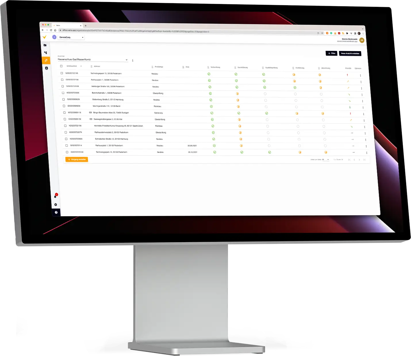
Digital job data from start to finish delivers maximum productivity. With search and filter options you find in seconds the jobs you used to dig through paper folders for. That saves time day to day – and precious minutes in an emergency.
For maximum overview you build your own tables in a few clicks and switch between them quickly for different information.
All jobs in one list
Freely definable table content
Search, find and filter in seconds
See job status at a glance
Adjust priorities with one click
Folders and views to stay organised
Smooth workflows need cooperation. Often it’s not only your own company’s specialists working together – external firms are involved in the jobs too.
Invite them to work on the same record as you through Vaira. You set in fine detail which data may be viewed, edited or even deleted. You can extend or revoke these permissions at any time to keep full control over your data.
The crew is out on the road, an emergency comes in – but the notebook isn’t on site? With Vaira that’s no longer a problem.
Everyone involved has all the latest data on their devices at any time – whether on the computer, tablet or smartphone. So they can react quickly to changes in the plan and work directly in the final record.
One licence includes it all. Vaira gives you a huge toolkit with which you can recreate your individual requirements yourself.
Unlike other software, no bespoke development is needed. Vaira already comes with all the standard, relevant tools your industry uses – user-friendly to operate, so you keep full control over your processes.
Control how your data is presented in tables and directories yourself.
Then export the data as a PDF in the form you want – complete with formatting, logos and images.
Do you get jobs from different clients who all place different requirements on you?
With Vaira you can cover all these requirements at once – regardless of sectors, file formats or interfaces.
Processes and documentation exist in every industry and trade – and Vaira has been used across them for years. That has given our team a wealth of know-how in digitalising processes, and we’re happy to help with your own digitalisation if you’d like.
Our steadily growing user base also brings new feature requests, which then find their way into Vaira. So if you’re missing a feature, we’re happy to talk about how we can build it into Vaira.
10 years developed together with the industry
A broad user base trusts Vaira
Flexible processes and documentation
Fully customisable working
Without costly in-house development
Optional support with your digitalisation
Efficient processes only work as a team – and that often includes not just your own staff but external partner firms too.
With Vaira you bring them into your projects with ease. Everyone works directly on the same record, while you specify in detail which information is visible, editable or deletable. You can adjust or withdraw your permissions at any time – so your data always stays under your control.
At Vaira, Software-as-a-Service means the service is fully included in the software. Alongside the usual bug fixes, you also get all feature updates as part of your licences. Gone are the days when you either let your software grow outdated or had to keep buying new CDs.
Support is free of charge too. As well as a comprehensive knowledge base with guides to every feature, our team is on hand with help and advice.
With Vaira you bring every important workflow around your construction site together in a single app.
From seamless documentation and the site diary through to time tracking down to the minute – all the information ends up exactly where you need it. Inspection reports, welding records or digital forms can be created in a flash and filed in an audit-proof way. Defect management, photo documentation and managing materials and equipment all become far simpler and more transparent too. Thanks to digital quantity take-offs and surveys, precise data is available to you instantly, with no media breaks or duplicated work.
All of this saves time, reduces errors and keeps office and site connected in real time. The result is a continuous, efficient workflow that speeds up your projects and keeps your records legally sound at all times.
Fully digital documentation
A shared data base to keep working from
Real-time collaboration with no waiting
No media breaks or duplicated work
Data exchange with external devices
Record construction progress seamlessly – with photos, notes, weather data and automatically captured details. Instead of scraps of paper or scattered files, you get one consistent, digital site diary that everyone involved can view at any time.
With Vaira you document directly on site, reduce sources of error and keep full transparency over how the project is progressing.
Capture all pipe and line data centrally and digitally – from surveys and materials through to photos and sketches. With Vaira you get a complete pipe log, seamlessly documented and linked directly to your project information.
That keeps you on top of things at all times, avoids media breaks and ensures every step of work is documented traceably and in an audit-proof way.
Capturing photos has never been so straightforward: with Vaira you take pictures right on site and assign them immediately to the correct project, step of work or location.
Supplemented with geodata, timestamps and comments, you get seamless photo documentation – clear, traceable and available at any time. This safeguards quality, meets your evidence obligations and does away with tedious paperwork.
Inspections can be carried out entirely digitally with Vaira – structured, error-free and legally sound. Mandatory fields and smart dependencies make sure that all the relevant data really is captured.
Whether it’s acceptance, an inspection or a sign-off: with digital verification, lasting traceability via an audit log and central storage, your inspection reports are ready to use immediately and available at any time.
Forget handwritten timesheets: with Vaira you record working hours conveniently on your smartphone – down to the minute and right where the work happens.
The data is transferred to the office in real time, so invoices, records and analyses are ready straight away. That doesn’t just save you time – it also avoids arguments and misunderstandings.
Proving your welds has never been so easy: Vaira takes the data straight from the machine and inserts it automatically into the digital welding log.
Supplemented with photos, geodata and further information, you get seamless documentation – fast, precise and absolutely reliable. That way you meet all your evidence obligations with no extra effort.
Defects can be recorded directly on the spot – with a photo, a precise description and a geolocation.
Vaira makes sure this information is passed straight to the right people and that the status can be tracked seamlessly. Problems get fixed faster, and you ensure transparent communication between client, office and site.
Capture lengths, areas and volumes easily with your smartphone – supported by augmented reality and, optionally, high-precision GNSS.
The measurements are transferred into the project automatically and are immediately available for billing, planning and records. With Vaira you save time, prevent transcription errors and get precise results right on site.
Whether it’s safety briefings, site set-ups or handovers – with Vaira you work with digital forms that contain mandatory fields and are logically linked.
This ensures no important information is missing and all data is captured in full. The result is structured, audit-proof documentation that’s available at any time.
The use cases shown are just a small snapshot of what Vaira can do. Whether it’s scheduling, workflow control or custom interfaces – the app grows with your requirements and adapts flexibly to your projects. So you always have the digital solution that really fits your day-to-day on site.
With Vaira you turn your smartphone into a flexible surveying tool you can use anytime, anywhere – with no heavy equipment at all.
All data is captured digitally straight away, which avoids transcription errors and keeps your records cleanly documented.
The results are available in the project immediately and can be used directly for planning, billing or records.
With Vaira’s AR surveying you see measurement points, lines and areas directly in the live image of your smartphone camera. That lets you capture geometries precisely, without having to rely on plans or estimates.
Especially in confusing or hard-to-reach areas, AR helps you keep your bearings and achieve precise results.
For large projects and even higher precision, you can connect external GNSS receivers from various providers to Vaira. With them you determine positions reliably even over long distances and obtain highly accurate, georeferenced data.
The captured points are automatically linked with all your other project information, creating seamless documentation.
The challenges of tape measures, paper sketches and transcription errors are all too familiar in the construction industry. Digitalising surveying can solve these challenges with ease.
With Vaira your on-site professionals become surveyors. Without endless training, the Vaira app enables them to take measurements via augmented reality or GNSS. Right at the open trench, with no need to coordinate with surveyors – and directly in digital form, with no effort spent on sketches, clean drawings or misunderstandings that have to be sorted out afterwards.
Intuitive surveying with your smartphone
Surveying via augmented reality and GNSS
Projects of any size via GNSS
Coordinate systems such as WGS84 or DHHN2016
Automated photo documentation for every measurement point
Clean digital drawing right on site
Combine with existing plans
Real-time transfer to cadastral updating
Multiple languages for every worker
Even in the Vaira app, on-site professionals can make adjustments to the survey data, the sketch and the attribute data. Components can be located, or additional photos can be taken for measurement points.
Back in the office you can carry on working on the digital sketch too. Adding and aligning existing plans, viewing photos or assigning components after the fact can all still be done here. Even surveys can be generated retrospectively from the office on the basis of the measurement data.
Data handover in Vaira works in two ways – either by export or via interfaces. You decide for yourself whether to export your survey as a data set (GeoJSON, DXF, Shapefile, etc.), or to connect your GIS directly to Vaira, for example, to exchange the data automatically.
You also have the option of exporting your survey data and sketches to a printable PDF, in order to submit them to your client in the usual form, for example.
You are currently viewing a placeholder content from YouTube. To access the actual content, click the button below. Please note that doing so will share data with third-party providers.
More InformationTorsten Köppert, a civil engineering specialist at Hermann Tönjes GmbH, has been working in trenches for almost 18 years. He knows all too well the challenges that paper documentation has brought.
Since Hermann Tönjes GmbH started using Vaira, his work has improved dramatically. His pleasing verdict: “For me personally, it has definitely changed for the better.”
Paperless documentation
All data always to hand
The simplest, fastest surveying
No more clean drawings or fair copies
Easy material location
Fewer queries and less stress
You are currently viewing a placeholder content from YouTube. To access the actual content, click the button below. Please note that doing so will share data with third-party providers.
More InformationGerlinde Röhr, also an invoicing clerk at Hermann Tönjes GmbH, uses Vaira in the office. She receives the documentation from her crews – including from Torsten Köppert – in real time at her desk.
She sums up at the end of the interview: “I can recommend Vaira because the whole finished submission is much tidier, much cleaner. Much easier to understand for everyone involved. And for us it’s definitely a saving in cost and time – and that, of course, is what matters most to us.”
Smooth coordination of everyone involved
Direct syncing between site and office
Clean, easy-to-understand surveys
Little effort for follow-up work
Faster to invoicing the job
You are currently viewing a placeholder content from YouTube. To access the actual content, click the button below. Please note that doing so will share data with third-party providers.
More InformationDr Carsten Sperl (Technical Domain Manager, GIS Product Manager) and Veronika Thalhofer (Digitalisation Project Lead) share their experience with Vaira from a one-year pilot project. The next step: rolling Vaira out further across the whole utility.
Veronika sums up in her interview: “We chose Vaira because they have a relatively large portfolio. Smartphone surveying is only one small part of it – we may well want to draw on other Vaira products in the future too.”
A clear mapping of requirements
Consistent documentation from external contractors
Correct and complete data
Easy import of survey data into your GIS
Connection to ERP, GIS, etc. possible
Minimal IT effort for maximum digitalisation
You are currently viewing a placeholder content from YouTube. To access the actual content, click the button below. Please note that doing so will share data with third-party providers.
More InformationAt EWE Netz GmbH, Torsten Memenga (Head of Contractor Management) and Uwe Kopplin (IT Process Manager) are enthusiastic about Vaira. EWE has been closely tied to Vaira from the very start and encourages its construction service providers to take the digital step.
Uwe concludes: “If someone asks me whether I’d recommend Vaira, I’d definitely say yes. The digital toolkit lets companies tailor their own processes perfectly to our requirements and to their own. Everything from documenting the site to communicating with the office can be mapped – so really no wish is left unfulfilled.”
Benefit from good data as a client
Design processes for your service providers together with Vaira
Drive digitalisation forward as a utility
Support from Vaira at every step
Not every survey has to be accurate to the millimetre. Especially when recording line routes and smaller projects, clients often allow more leeway on accuracy.
The problem: these small jobs often aren’t worth the major set-up of laser systems and tie up valuable capacity needed for bigger jobs.
With Vaira you take the middle path: sufficient accuracy with minimal effort. That brings the economics back into your blended costing.
For jobs with no millimetre requirement
The fastest, simplest digital measurement method
Data ready for onward digital work straight away
A choice between AR and GNSS surveying
External antennas with a correction service can be connected
Make even small jobs economically worthwhile
Survey using your smartphone or tablet alone. Using the internal sensors and the camera image, and calculated by photogrammetric methods, you place virtual points in the real world via augmented reality.
Average accuracy*:
approx. ± 7 cm
Survey with Vaira and an optional external GNSS antenna from one of our many partners. With NTRIP correction services you achieve precise surveys over distances of any size.
Average accuracy*:
down to 1 cm
Record the construction site by video using the Vaira app, your smartphone and the RTK antenna. From the footage, the Vaira app and our backend calculate a georeferenced 3D model in which you can still take measurements afterwards.
Average accuracy*:
down to 1 cm
*depending on handling, the antenna chosen (if any), environmental factors and the correction service used
Whether it’s maintaining gardens, laying paving or roofing houses: wherever building happens, documentation is needed as proof of work. And there’s no better advertising material than your own successful projects.
Vaira gives you a tool to produce and capture this data cleanly and digitally. With your smartphone you can easily survey 2D areas via augmented reality or GNSS. By entering a height you can also generate simple volumes, giving you a quick overview of the volumes of your building and waste materials.
Vaira’s 3D model function lets you create images of your project with ease. You can use them in the office to keep working – for example, to have Vaira automatically calculate precise volumes from the 3D models for your billing.
Or you use the 3D models for your presentations and marketing material to show off what you can do.
For jobs with no millimetre requirement
The fastest, simplest digital measurement method
Data ready for onward digital work straight away
3D models for onward work & marketing
A choice between AR and GNSS surveying
External antennas with a correction service can be connected
Survey using your smartphone or tablet alone. Using the internal sensors and the camera image, and calculated by photogrammetric methods, you place virtual points in the real world via augmented reality.
Average accuracy*:
approx. ± 7 cm
Survey with Vaira and an optional external GNSS antenna from one of our many partners. With NTRIP correction services you achieve precise surveys over distances of any size.
Average accuracy*:
down to 1 cm
Record your project by video using the Vaira app, your smartphone and the RTK antenna. From the footage, the Vaira app and our backend calculate a georeferenced 3D model in which you can still take measurements afterwards.
Average accuracy*:
down to 1 cm
*depending on handling, the antenna chosen (if any), environmental factors and the correction service used
You are currently viewing a placeholder content from Vimeo. To access the actual content, click the button below. Please note that doing so will share data with third-party providers.
More InformationYou are currently viewing a placeholder content from YouTube. To access the actual content, click the button below. Please note that doing so will share data with third-party providers.
More InformationYou need to load content from reCAPTCHA to submit the form. Please note that doing so will share data with third-party providers.
More InformationYou are currently viewing a placeholder content from Facebook. To access the actual content, click the button below. Please note that doing so will share data with third-party providers.
More InformationYou are currently viewing a placeholder content from Hubspot Embedded Content. To access the actual content, click the button below. Please note that doing so will share data with third-party providers.
More InformationYou are currently viewing a placeholder content from HubSpot. To access the actual content, click the button below. Please note that doing so will share data with third-party providers.
More InformationYou are currently viewing a placeholder content from Hubspot Meetings. To access the actual content, click the button below. Please note that doing so will share data with third-party providers.
More Information