
S599
GNSS Receiver
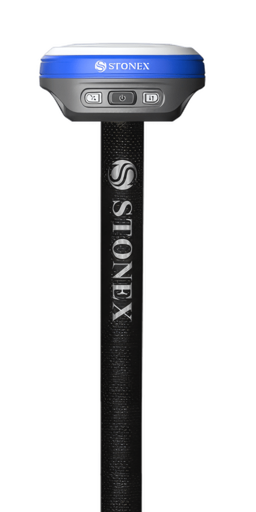
The Stonex S599 weighs 385 grams and measures 98 × 98 × 46 millimeters – and still delivers full multi-frequency accuracy across every satellite system. You connect it to the Vaira app directly over Bluetooth, on iOS and Android. Your surveys flow straight into the digital construction file – including an absolutely positioned 3D model you can keep working with in your own systems.
Typical uses: service connections, FTTx documentation, trench take-offs and as-built capture in civil and road construction.
- Centimeter-accurate: 8 mm + 1 ppm in RTK
- Tilt compensation up to 60 degrees – no more plumbing the pole
- Just 385 g, IP68, 12 hours of battery life
- Connected in Vaira for iOS and Android
- Buy or rent – your call
Buy or rent – with no obligation, through our partner Stonex. In the form you choose whether you want a rental device or a purchase quote.
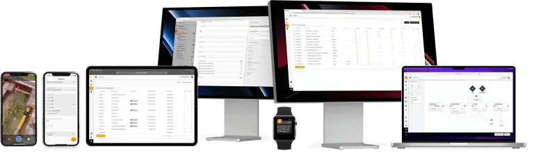
Digital construction file and 3D models
Unlock the full potential with Vaira
The S599 is connected to Vaira out of the box. You start the survey in the app, the receiver supplies the position – and the finished job lands in the digital construction file, complete with photo, component and measurements. Every survey automatically produces an absolutely positioned 3D model you can reuse in your own systems.
- Perfect for proving the work performed on construction projects
- No setup required
- Absolute positioning of the 3D models
- Created automatically with every survey
- The ideal answer for FTTx rollout
Centimeter-accurate – even at a tilt
RTK: 8 mm + 1 ppm horizontal
Vertical 15 mm + 1 ppm. Built for network RTK with baselines up to 30 km. In static mode, 2.5 mm + 0.5 ppm horizontal is achievable.
Tilt compensation up to 60 degrees
The IMU runs at 200 Hz. At 30 degrees of tilt the deviation is 2 cm, at 60 degrees it is 4 cm. You no longer have to hold the pole plumb – not at building corners, not under overhangs, not in a narrow trench.
Every satellite system, 1,408 channels
GPS, GLONASS, Galileo, BeiDou, QZSS, IRNSS and SBAS – on every relevant frequency band. RTK initialization in under 5 seconds, signal reacquisition in under 1 second.
Correction data from your own service
The S599 works with the usual network RTK correction services, SAPOS for example. The correction data reaches the receiver through your smartphone – there is no separate SIM card in the device for you to manage.
Small enough for your jacket pocket
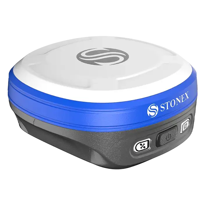
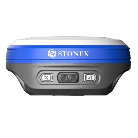
Just 385 g at 98 × 98 × 46 mm
The S599 is one of the smallest receivers in its class. On the pole, in your backpack or in your jacket pocket – you barely notice it across a full working day.
IP68 and tested for drops up to 1.5 m
Dust- and waterproof to IP68, shock-resistant from drops of up to 1.5 meters. Operates from −30 °C to +60 °C – from January frost to midsummer heat.
12 hours of runtime, 4 hours to charge
The built-in 6,000 mAh battery lasts a full working day. Charging runs over USB-C with Power Delivery – the same cable as your smartphone.
Works with iOS and Android
Plenty of GNSS receivers lock you into one platform. The S599 is connected in Vaira on both: for iPhones as well as Android smartphones.
- Vaira app for iOS
- Vaira app for Android
- Connected over Bluetooth
How to get your S599
You can buy the receiver or rent it. Either way it runs through our partner Stonex – we pass your request on and you get a no-obligation quote.
Buy
A one-time purchase, yours to use indefinitely – with no ongoing hardware costs. The right call if you survey regularly and need the device in your team permanently.
Rent
For peak project loads, pilot phases, or when you first want to find out whether GNSS surveying fits your workflows. You can switch to a purchase later on.
In the form you choose “Rental device” or “Purchase quote”. All information is provided without warranty and subject to change.
Technical specifications
Mechanics and environment
98 × 98 × 46 mm
385 g
IP68 (dust- and waterproof)
Drops of up to 1.5 m without damage
−30 °C to +60 °C
−40 °C to +80 °C
100%, non-condensing
Integrated multi-frequency antenna with zero phase center and internal multipath suppression
Power and battery
Built in, 3.65 V, 6,000 mAh (not replaceable)
Up to 12 hours
Typically 4 hours
USB-C with Power Delivery, 12 V
Positioning and accuracy
8 mm + 1 ppm RMS
15 mm + 1 ppm RMS
2.5 mm + 0.5 ppm / 5 mm + 0.5 ppm RMS
± 60 degrees
2 cm at 30 degrees, 4 cm at 60 degrees
200 Hz
Under 5 seconds
Under 1 second
Over 99.9%
Under 20 cm RMS / under 60 cm RMS
As with every GNSS system, accuracy depends on satellite geometry, obstructions, multipath effects and atmospheric conditions. Network RTK figures refer to the nearest physical reference station.
GNSS signals
L1 C/A, L1C, L2P, L2C, L5
L1, L2, L3
E1, E5a, E5b, E6
B1I, B2I, B3I, B1C, B2a, B2b
L1, L2, L5, L6 / L5 / yes
1,408
Up to 20 Hz
B2b PPP, Galileo HAS
Connectivity and data
2.1 + EDR and 5.0 – connection to the Vaira app
802.11 b/g/n
USB-C for charging and data transfer
Configuration, status checks, data download and updates via the browser (smartphone, tablet or PC with Wi-Fi)
CMR, RTCM 3.0, RTCM 3.2, DGPS
NMEA 0183
8 GB
Full S599 datasheet: download the PDF · all GNSS products in the Stonex product range.
Practical notes for using it with Vaira
Vaira app for iOS and Android, connected over Bluetooth
Access to a network RTK service (SAPOS, for example) is required – it is not part of the device
GNSS surveying gets enabled for your organization – just talk to us when you set things up
Best done outdoors, starting straight from “Surveying” in the app
Like every IMU antenna, the tilt sensor needs a short warm-up and initialization phase after switching on before it works reliably. The Vaira app shows you the IMU status – wait for the green light and your tilted measurements will be spot on.